
English
Standard visible-light and thermal cameras frequently fail to provide actionable data in complex, high-interference environments. This limitation leaves severe blind spots in long-range observation. Decision-makers tasked with securing perimeters, monitoring vast ecological zones, or inspecting infrastructure struggle daily to differentiate between benign environmental factors and actual anomalies at extended distances. Distinguishing synthetic camouflage from natural foliage or identifying crop stress hidden within shadows requires advanced optical data. Deploying a Multispectral camera shifts your operational capability from simple detection to precise material, chemical, and biological identification. We will break down the specific long-range tasks requiring multispectral imaging, evaluate available hardware configurations from fixed masts to UAV payloads, and outline the technical criteria necessary for a successful procurement evaluation.
Multispectral cameras capture specific wavelength bands across the electromagnetic spectrum, enabling the identification of material properties, vegetation health, and concealed threats over vast distances.
Primary long-range applications include border security, large-scale precision agriculture, forestry management, geological surveying, and critical infrastructure monitoring.
Hardware selection dictates operational success; buyers must evaluate the trade-offs between static payloads, a Multi-spectrum PTZ Camera, a Dual Sensor Surveillance Camera, and drone-mounted systems based on tracking requirements and environmental constraints.
Implementation carries specific risks, notably massive data storage requirements, complex calibration processes, and the need for specialized analytics software to interpret spectral signatures.
Visible light represents a tiny fraction of the electromagnetic spectrum, spanning only 400 to 700 nanometers. Standard surveillance cameras capture only what the human eye can see, limiting their utility in complex environments. Multispectral imaging breaks this limitation by capturing discrete bands of light outside the visible range. Common bands include Near-Infrared (NIR), Short-Wave Infrared (SWIR), Mid-Wave Infrared (MWIR), and Long-Wave Infrared (LWIR). Capturing these specific wavelengths allows operators to observe chemical and physical properties directly. You can identify moisture content in soil, detect specific hydrocarbon gas leaks, and measure the cellular health of vegetation. This process transforms standard video feeds into highly specialized industrial data arrays, providing quantifiable metrics rather than just visual approximations.
Spectral Band | Wavelength Range | Primary Long-Range Application |
|---|---|---|
Visible (RGB) | 400nm - 700nm | Baseline visual identification and color verification. |
Near-Infrared (NIR) | 700nm - 1000nm | Vegetation health analysis, camouflage detection, low-light imaging. |
Short-Wave Infrared (SWIR) | 1000nm - 2500nm | Penetrating fog/smoke, moisture detection, maritime tracking. |
Mid-Wave Infrared (MWIR) | 3µm - 5µm | Optical gas imaging, high-contrast thermal detection. |
Long-Wave Infrared (LWIR) | 8µm - 14µm | Zero-light thermal imaging, human/vehicle tracking. |
Long-range imaging faces severe atmospheric physics challenges. Rayleigh and Mie scattering degrade visible light over long distances, causing images to appear washed out. High humidity creates dense fog and haze, physically blocking visible light photons. Heat mirages, known as atmospheric scintillation, distort ground-level observation and ruin image clarity. Specific spectral bands mitigate these visual degradations effectively. SWIR bands penetrate dense smoke and fog because their longer wavelengths bypass small airborne particulates rather than scattering off them. This physical advantage allows multispectral sensors to maintain high contrast and sharp edges. Operators retain clear visibility at ranges exceeding ten kilometers, where standard optical cameras fail completely.
Success in long-range monitoring requires moving past simple detection. Spotting an unidentified object at five kilometers offers limited operational value. You must definitively classify its material composition and state to initiate a response. Multispectral data provides the necessary signatures for this classification. A standard thermal camera detects a warm shape in a forest, leaving operators guessing. A multispectral system identifies whether that shape is a running vehicle or a large animal by analyzing the specific emissivity and reflectance of the target. It separates the heat signature from the surrounding foliage using NIR data, shifting the baseline from guessing to absolute identification.
Securing vast, remote borders requires specialized optical tools capable of defeating sophisticated intrusion tactics. Standard cameras fail against modern concealment methods. Multispectral sensors provide distinct, measurable advantages for perimeter defense.
Camouflage Defeat: Intruders often use synthetic materials designed to blend into natural foliage. Human eyes and standard cameras cannot see the difference. NIR and SWIR bands expose these synthetic materials instantly. Natural chlorophyll reflects NIR light intensely, appearing bright white on a monitor. Synthetic camouflage absorbs NIR light. The resulting image shows the camouflage as a stark, dark anomaly against bright vegetation, immediately alerting operators.
Disturbed Earth Detection: Smugglers frequently bury contraband or dig tunnels beneath border fences. Multispectral sensors analyze soil moisture and composition differences. Recently turned earth retains different moisture levels than undisturbed, compacted soil. Operators identify these subtle spectral differences along vast border stretches, locating hidden caches without physical patrols.
Maritime Surface Tracking: Coastal monitoring faces constant water glare, sea fog, and heavy rain. Specific wavelengths cut through these environmental barriers. SWIR imaging excels at contrasting solid objects against water surfaces. Water strongly absorbs SWIR light, appearing pitch black. Fiberglass or metal vessels reflect SWIR light, creating massive contrast that allows operators to identify distant vessels or floating anomalies with high precision.
Managing massive ecological zones requires data beyond visual inspection. Multispectral imaging provides quantifiable metrics for environmental health, allowing forestry teams to act proactively.
Large-Scale Canopy Health Assessment: Forestry teams use the Normalized Difference Vegetation Index (NDVI). This index compares red and NIR light reflectance to monitor disease progression across thousands of acres. Operators spot insect infestations or fungal diseases weeks before trees show visible decay, allowing for targeted intervention.
Wildfire Risk and Burn Scar Mapping: Fire prevention relies on identifying dry, high-risk vegetation zones. Multispectral sensors map moisture content across vast forests, highlighting areas prone to ignition. Post-fire, elevated fixed-mount surveys assess soil damage. They map burn scars accurately to plan immediate rehabilitation efforts and prevent mudslides.
Water Quality and Pollution Tracking: Detecting chemical spills requires specialized optics. Multispectral cameras spot algae blooms or illegal industrial discharges in large bodies of water. They identify specific chemical signatures from distant vantage points, enabling rapid response to ecological threats before they spread.
Commercial farming operations span thousands of hectares, making manual inspection physically impossible. Multispectral imaging drives modern precision agriculture by providing field-level data from elevated positions.
Yield Prediction and Crop Stress: Farmers move beyond standard visual inspections. Multispectral data detects nutrient deficiencies and water stress early. Plants alter their cellular structure when stressed, changing their light reflectance weeks before wilting becomes visible to the human eye.
Pest and Disease Vector Tracking: Crop diseases exhibit specific spectral signatures. Operators isolate these signatures across massive commercial farming operations. They target pesticide application only where needed, reducing chemical usage and protecting overall crop yields.
Large-Scale Precision via UAVs: Mounting multispectral cameras on drones enables rapid mapping. Drones perform high-resolution pattern recognition across massive agricultural fields. Aerial multispectral surveys provide complete topographical health maps that ground-based sensors cannot match.
Protecting critical infrastructure demands proactive anomaly detection. Multispectral sensors identify invisible threats before they cause catastrophic failure or environmental damage.
Optical Gas Imaging (OGI): Refineries and pipelines face constant leak risks. Many hydrocarbon gases, like methane, are entirely invisible to the naked eye. Multispectral sensors operating in the MWIR band detect these invisible toxic gas plumes. They allow operators to monitor facilities from safe standoff distances, preventing explosions.
Industrial Defect Detection: Sprawling solar farms require constant monitoring. Multispectral cameras identify thermal and material anomalies. A defective solar panel exhibits a specific spectral signature, often showing up as a distinct hot spot. Operators spot equipment failure or surface degradation instantly.
Geological Formations and Mining Operations: Mining safety relies on structural integrity. Multispectral bands analyze soil composition and map minerals. Operators monitor the structural integrity of tailings dams continuously. Detecting moisture shifts in dam walls prevents catastrophic failures and protects downstream communities.
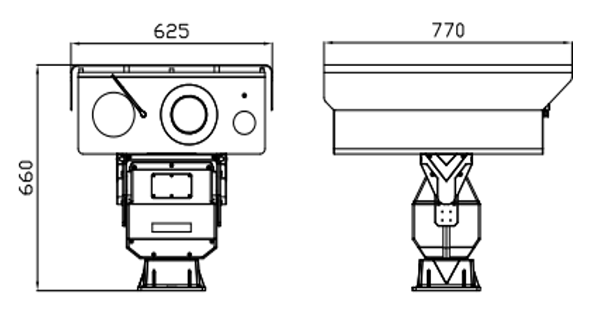
Dynamic environments require agile hardware. A Multi-spectrum PTZ Camera provides active tracking capabilities. Operators pan, tilt, and zoom to investigate specific spectral anomalies across massive areas. This configuration is ideal for border security and maritime surveillance where targets move rapidly across wide fields of view. Active incident response relies heavily on this agility. However, moving parts require higher maintenance. Mechanical wear is a reality in harsh environments, and slip rings must handle massive data throughput. Stabilization becomes critical at maximum zoom. Even minor wind vibrations blur spectral data at long distances. You must ensure the mounting infrastructure, such as a lattice tower or concrete mast, can support heavy, dynamic payloads without swaying.
Many perimeter security applications require a balanced approach rather than full scientific analysis. A Dual Sensor Surveillance Camera combines a high-resolution visible light sensor with a secondary sensor. This secondary sensor is often thermal or a specific multispectral band like NIR. Both sensors sit within a single ruggedized housing. This aligns perfectly with infrastructure monitoring. Operators pair baseline visual identification with heat or NIR data side-by-side. You sacrifice the granular spectral data of a dedicated 5-band array. However, you gain a highly practical tool for general security. It simplifies operator training and data interpretation, allowing standard security personnel to identify threats without needing a background in optical physics.
Extreme zero-light environments demand specialized targeting. A Thermal Laser PTZ Camera utilizes active laser illumination paired with thermal imaging. This provides exceptional long-range targeting and detection at night. You must evaluate this active thermal approach against passive multispectral cameras to determine the right fit for your facility.
Feature | Thermal Laser PTZ | Dedicated Multispectral Camera | Dual Sensor Camera |
|---|---|---|---|
Primary Strength | Extreme zero-light targeting and heat detection. | Material classification and vegetation health. | Balanced visual and thermal/NIR monitoring. |
Illumination Method | Active (Laser illumination). | Passive (Relies on ambient light/reflectance). | Passive (Visible + Thermal). |
Ideal Field Use Case | Nighttime border patrol, target tracking. | Agriculture, camouflage defeat, gas imaging. | Perimeter defense, general facility security. |
Data Output Format | High-contrast thermal and illuminated video. | Multiple discrete wavelength data streams. | Blended or side-by-side visual/thermal video. |
Deployment methods drastically alter operational capabilities. Fixed mast installations provide continuous, active monitoring. They offer 24/7 perimeter and infrastructure overwatch. Fixed systems handle heavier lenses, require zero battery management, and connect directly to hardwired fiber-optic networks for stable data transmission. Conversely, UAV payloads offer on-demand, large-scale mapping. Multispectral drones scan vast topographical and agricultural areas rapidly, accessing terrain that ground vehicles cannot reach. You must determine your primary operational need. Choose drones for periodic, wide-area scanning and mapping. Choose fixed masts for constant, targeted surveillance of specific high-value assets.
Long-range imaging requires precise optical calculations. You must understand pixel pitch and focal length. These metrics determine your pixels-on-target at specific distances. Identifying a vehicle at two kilometers requires different optics than identifying one at ten kilometers. High-resolution sensors with small pixel pitches (e.g., 12µm) provide better detail. However, they require massive lenses to gather enough light. Aperture size directly impacts light gathering capability. Capturing narrow spectral bands inherently reduces incoming light. You need large, high-quality lenses to prevent digital noise in the final image, which significantly increases the physical footprint of the camera.
Size, Weight, and Power (SWaP) dictate deployment feasibility. You must evaluate the payload constraints of the camera system. Heavy cameras draw significant power for internal heaters, wipers, and PTZ motors. This becomes critical when integrating with UAVs or remote, solar-powered masts. A heavy camera drastically reduces drone flight time. A high-power camera overwhelms remote solar arrays during winter months. Ensure the camera housing and mounting hardware align with your deployment vehicle. Drone gimbals require perfect balance and lightweight materials. Static towers require robust, wind-resistant mounts to prevent image shake at high zoom levels.
Remote deployments expose hardware to brutal conditions. You must evaluate ruggedization standards rigorously. Look for IP67 or IP68 ratings to ensure complete dust and water resistance. Nitrogen-purged housings prevent internal lens fogging during rapid temperature shifts. Extreme temperature tolerances are non-negotiable for desert or arctic deployments. Lens coatings play a crucial role. Specialized germanium windows allow thermal wavelengths to pass through, while sapphire glass protects SWIR sensors. These coatings must resist environmental fouling, sand abrasion, and chemical exposure. Integrated wipers and pressurized washer systems are mandatory for coastal or heavy industrial sites.
Hardware is useless without effective data processing. You must assess edge computing versus cloud analytics. Edge computing processes spectral indices directly on the camera hardware. This reduces bandwidth requirements significantly, sending only the analyzed anomaly alerts to the control room. Cloud analytics require transmitting raw data to a centralized server. This offers deeper analysis but demands massive network infrastructure. Ensure VMS compatibility before procurement. The multispectral data feeds must integrate cleanly into your existing Video Management Systems via ONVIF protocols. Geographic Information Systems (GIS) integration is vital for mapping and agricultural applications.
Multispectral imaging generates unprecedented volumes of data. A single camera often captures four to six simultaneous video streams. This bandwidth reality overwhelms standard network infrastructure. Transmitting uncompressed spectral data across remote wireless links frequently causes system failure and dropped frames. A standard 1080p camera requires 2-4 Mbps, while a four-band multispectral array streaming simultaneously can demand upwards of 40 Mbps. You must upgrade your network backbone to handle this throughput. Implement intelligent mitigation strategies immediately. Use frame-rate throttling for non-critical monitoring periods. Deploy edge-based data compression to shrink file sizes before transmission. Utilize event-triggered recording to capture high-resolution data only when anomalies occur.
Spectral data loses value if it becomes inaccurate. Radiometric calibration is a strict requirement for multispectral systems. Sensors drift over time due to temperature changes and component aging. You must perform frequent calibration using standardized reflectance panels. Ambient light sensors help adjust for changing cloud cover and sun angles during operation. Without rigorous calibration, NDVI readings become useless, and material classification algorithms will fail. Establish a strict maintenance schedule. Train on-site personnel to perform radiometric baseline checks weekly. Neglecting this process turns a precision scientific instrument into an expensive, standard camera.
Deploying multispectral technology requires careful planning and precise execution. Follow these actionable steps to ensure operational success:
Define your exact operational range and the specific materials you need to identify before selecting spectral bands.
Audit your current network infrastructure to ensure it can handle multi-stream data transmission without latency.
Select your form factor based on environmental constraints, choosing fixed masts for continuous overwatch and UAVs for wide-area mapping.
Establish a strict radiometric calibration schedule using standardized reflectance panels to maintain data accuracy.
Integrate edge-computing solutions to process spectral indices locally, reducing the burden on your central servers.
A: Multispectral cameras capture data across 3 to 15 discrete, broad wavelength bands. Hyperspectral cameras capture data across hundreds of narrow, contiguous spectral bands. Multispectral is highly effective for targeted tasks like vegetation health or camouflage detection. Hyperspectral provides deeper chemical analysis but generates massive data loads and requires complex processing.
A: No. Multispectral cameras cannot see through solid walls, metal, or dense structures. They capture reflected or emitted electromagnetic radiation from the surface of objects. They excel at penetrating atmospheric obscurants like smoke, fog, and haze, but they do not possess X-ray or ground-penetrating radar capabilities.
A: Plants reflect different amounts of near-infrared (NIR) and visible light based on their cellular health. When a plant experiences water or nutrient stress, its internal structure changes. This alters its light reflectance before visible wilting occurs. Multispectral cameras measure these subtle reflectance changes to identify stress early.
A: It depends on the specific bands utilized. Bands relying on reflected sunlight, such as Visible, NIR, and SWIR, require ambient light or active illumination to function at night. Thermal bands, including MWIR and LWIR, detect emitted heat signatures and function perfectly in total darkness without any external light source.
A: Radiometric calibration ensures the camera accurately measures the true reflectance or temperature of an object. It involves adjusting the sensor data using known reference targets, like a calibrated reflectance panel. This corrects for sensor drift, varying sunlight, and atmospheric conditions, ensuring consistent and reliable spectral data over time.
A: Short-Wave Infrared (SWIR) light scatters much less than visible light when passing through atmospheric particles. This allows SWIR sensors to penetrate dense fog, haze, and smoke effectively. It provides high-contrast imaging at extreme distances where standard visible cameras capture only a washed-out, unusable image.


